Morocco’s growing use of unmanned aerial vehicles is changing what public-safety agencies can see from the air. But as drone fleets expand, the central challenge may no longer be simply putting more aircraft in the sky. It may be determining how to turn the enormous volume of information they collect into useful, timely intelligence.
A drone can capture hours of video, thousands of photographs, thermal imagery, geographic coordinates, and other sensor data during a single operation. However, human operators cannot examine every frame with equal attention. As the number of aircraft and missions increases, the value of the system will increasingly depend on the ability to identify what deserves attention and present it to decision-makers without removing human judgment from the process.
Morocco’s national police force has already placed growing drone capabilities at the center of its technological modernization. At its 2026 Open Days, the General Directorate of National Security (DGSN) presented a fleet covering eight categories of unmanned aerial vehicles and described their integration into security operations. The event also showcased a Moroccan-made vertical-takeoff-and-landing drone intended to support surveillance and field intervention.
The next stage of this expansion could therefore be less about the number of drones available and more about the intelligence architecture surrounding them.
From aerial video to aerial intelligence
Traditional drone operations often place a heavy burden on the operator. A pilot or monitoring team watches live feeds, searches recorded footage, interprets images and attempts to identify unusual activity while simultaneously managing the aircraft and communicating with other personnel.
Yet that model is increasingly difficult to navigate when multiple UAVs operate across large areas. Artificial intelligence offers a way to change the workflow. Instead of requiring personnel to continuously watch every second of raw footage, AI systems can process imagery and identify observations that warrant human attention.
For example, an analytical system could flag a vehicle appearing in a restricted area, identify a newly visible obstruction on a road, detect a concentration of people in an unexpected location, or highlight a possible heat signature during a nighttime search operation.
The important point is not that AI should make the final decision. Rather, it can help determine which parts of a large information stream deserve closer examination.
The National Institute of Standards and Technology (NIST) is already evaluating AI capabilities for identifying public-safety events from imagery, illustrating the broader movement toward automated interpretation of visual information for emergency and public-safety applications.
For Morocco, this could become particularly valuable as UAV deployments grow from individual missions toward coordinated, repeatable monitoring.
Combining more than one type of information
The most useful public-safety intelligence will rarely come from a single camera.
A visible-light camera may show a vehicle, structure, person, or landscape clearly during daylight. Thermal imaging can reveal heat differences that are difficult or impossible to detect visually. Location information can establish exactly where an observation occurred. Historical data and operational context can help determine whether an observation is unusual.
Combining these sources can provide a more complete picture than relying on any one sensor. Consider a wildfire response. A visible camera might show smoke and damaged vegetation, while thermal data could help identify areas of elevated heat. Geographic information could place those observations on an operational map, while previous imagery could help responders understand how the affected area has changed.
The same principle can apply to search-and-rescue operations. A UAV does not necessarily need to identify a person with certainty. It may instead identify an area containing an unusual thermal or visual pattern and direct rescuers toward that location for verification.
This is where AI, behaving less like an automated pilot and more like an information-management layer, is a crucial and game-changing addition to highly sensitive operations.
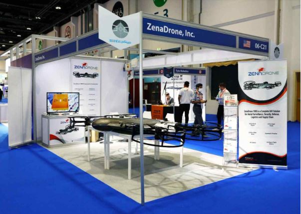
Industry examples such as ZenaDrone already demonstrate how autonomous UAV platforms can combine flight automation, image capture, sensing, and analytical capabilities for inspection and monitoring applications. The broader lesson is applicable beyond any individual manufacturer: the drone itself is only one component of an intelligence system.
Making large-area monitoring more repeatable
One of the strongest advantages of UAVs is their ability to repeatedly observe locations that may be difficult, dangerous or expensive for personnel to inspect. That could include remote terrain, infrastructure corridors, industrial areas, disaster zones, coastlines or other locations where conventional ground-based observation is limited.
Autonomy can make this process more consistent.
Instead of treating every flight as an isolated event, public-safety organizations could establish repeatable missions in which UAVs survey defined areas according to predetermined routes and collect comparable information over time.
AI can then help identify changes between observations.
A road that was clear during one flight might later contain an obstruction. A section of infrastructure might show a new visual anomaly. A previously empty area might develop an unusual concentration of activity.
The value comes not simply from seeing the environment, but from recognizing how it has changed.
NIST has described UAVs as valuable tools for public-safety personnel because they can provide rapidly deployable aerial visibility while reducing risks to responders and the public. Its research also highlights the potential for UAVs to support communications when conventional infrastructure is damaged or unavailable.
For a country with varied geography and large areas that can be challenging to monitor continuously, repeatable aerial observation could become an important complement to ground-based capabilities.
Reducing information overload
More data does not automatically produce better decisions.
In fact, an expanding drone fleet could create a new operational problem: information overload.
If every UAV produces a continuous stream of high-resolution imagery, operators may face thousands of observations competing for attention. The problem then shifts from collecting information to prioritizing it.
AI can potentially help by ranking observations according to predefined operational criteria.
Instead of presenting an operator with dozens of equally weighted alerts, an analytical system could categorize observations according to factors such as location, confidence, urgency, sensor agreement or deviation from normal conditions.
A possible interface might show:
- High priority: observation requiring immediate human review
- Medium priority: unusual activity requiring assessment
- Low priority: routine observation retained for records
- No action: information consistent with expected conditions
Such prioritization would not eliminate the operator. It would instead allow the operator to spend more time examining the observations most likely to matter.
This distinction is especially important in public safety, where an AI-generated alert is not the same thing as a verified event.
Human verification must remain central
The more consequential the decision, the more important human oversight becomes.
AI systems can misinterpret imagery. A shadow can resemble an object. Heat can have multiple explanations. Crowds can be misclassified. Poor weather, unusual lighting, camera limitations or incomplete training data can produce false alerts.
For that reason, AI-generated observations should be treated as analytical assistance rather than unquestionable conclusions.
The OECD’s work on AI governance emphasizes human agency and oversight, transparency, accountability and mechanisms for managing risks throughout the AI lifecycle. It also warns that AI outputs can be affected by limitations in data and model performance.
This is particularly significant when AI is used in law enforcement or public-safety contexts. The OECD notes that inaccurate or biased systems can produce false positives or false negatives and stresses the importance of testing, validation, human review and appropriate safeguards.
For Morocco, an AI-enabled UAV strategy should therefore establish clear boundaries around what an algorithm can recommend and what requires human confirmation.
A system might identify a potential incident. A trained official should determine whether the observation is credible and what action, if any, is appropriate.
That separation between detection and decision could become one of the most important principles of responsible drone intelligence.
Building accountability into the system
Responsible deployment also requires more than keeping a person in the loop.
Public-safety organizations need to know how an alert was generated, what data contributed to it, who reviewed it, and what action followed.
Maintaining audit trails can help answer these questions.
If an AI system identifies an anomaly, the organization should ideally be able to preserve the relevant imagery, location information, system output and subsequent human assessment. Such records can help investigators evaluate system performance and determine whether an error resulted from the algorithm, the underlying data, operational conditions or human interpretation.
Cybersecurity is equally important. Connected UAVs increasingly rely on communications networks, cloud infrastructure, navigation systems and software. NIST research on uncrewed systems highlights cybersecurity and AI risk management as particularly important in safety-critical applications, including public safety and infrastructure operations.
A compromised drone or manipulated data stream could therefore create risks that extend beyond the aircraft itself.
Regulation will have to keep pace
Drone expansion cannot be separated from aviation regulation, privacy, communications and public accountability.
Morocco’s aviation information infrastructure continues to evolve, with the country’s aeronautical Information Service publishing current updates and amendments to aviation information. Morocco’s telecommunications regulator, ANRT, also regulates certain aeronautical communications stations and requires prior authorization for relevant installations.
On the world stage, the International Civil Aviation Organization (ICAO) emphasizes risk-based authorization, qualified operators, and appropriate oversight for remotely piloted aircraft operations. Its model UAS framework also recognizes that national drone rules must address issues such as communications, privacy, property rights, safety and the broader operational environment.
As AI becomes more deeply integrated into UAV operations, regulatory thinking may need to address not only where and when a drone can fly, but also how information generated during those flights can be processed, retained, shared, and used.
From fleet expansion to intelligence infrastructure
Morocco’s expanding UAV capabilities create an opportunity to think beyond individual aircraft. The real transformation could come from connecting drones, sensors, mapping systems, communications networks, AI analytics, and trained personnel into a coordinated public-safety information architecture.
In that model, the drone is the collection point rather than the final product. AI thus becomes the layer that helps organize and interpret what the aircraft observes. Meanwhile, human experts remain responsible for determining what those observations mean and what action should follow. Governance and cybersecurity provide the safeguards that keep the system accountable.
Such an approach could support a range of missions, from disaster response and search and rescue to infrastructure monitoring, emergency assessment, and large-area situational awareness. But the objective should not be to automate public safety simply because automation is technically possible. The objective should be to help public-safety personnel make better-informed decisions with less delay and less information overload.
Morocco’s UAV expansion provides the physical foundation for that possibility. The next question is whether the country can build the analytical, regulatory and institutional systems needed to turn aerial data into trustworthy intelligence.
The future of public-safety drones may therefore be measured not by how many aircraft can take to the sky, but by how effectively those aircraft can help people understand what is happening below them—and how responsibly that understanding is translated into action.