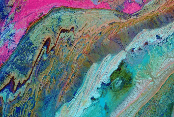
Agadir – National Aeronautics and Space Administration (NASA) re-shared a breath-taking picture of Morocco’s Anti-Atlas Mountains that were “formed as a result of the African and Eurasian tectonic plates colliding about 80 million years ago.”
The Terra satellite took the picture 440 miles (708 kilometres) above Earth’s surface, in 2007. “The photo was taken in infrared light – which is invisible to the naked eye – to highlight the different layers of rock and sediment, giving the tie-dye appearance,” read the post from NASA.
The picture displays the different layers that are below earth’s surface in southwestern Morocco, such as limestone, sandstone, clay stone, and gypsum.
The picture was taken by the ASTER instrument on the Terra satellite, which was the first satellite to form the Earth Observing System (EOS) when it launched in 1999. According to NASA, the name was derived from the Latin word for ‘Earth,’ Terra.
Read also: TRAPPIST-1: Moroccan Researchers Contribute to New NASA Discovery
The Advanced Spaceborne Thermal Emission and Reflection Radiometer (ASTER) takes high-resolution images of the Earth in 14 different wavelengths of the electromagnetic spectrum, ranging from visible to thermal infrared light.
According to an earlier post by NASA, the Terra satellite “was built to last for six years and 30,000 orbits.” 20 years later, however, Terra and its onboard instruments continue on a “mission of discovery, providing data about the planet we call home.”
It was originally launched to understand the connections between Earth’s atmosphere, land, snow and ice, ocean, and energy balance. This would allow us to “understand Earth’s climate and climate change and to map the impact of human activity and natural disasters on communities and ecosystems,” according to NASA.